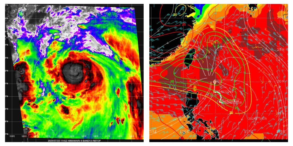
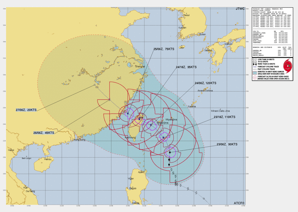
Typhoon Gaemi is forecast to begin a sharper turn to the northwest in around 24 hours

Typhoon Gaemi is forecast to begin a sharper turn to the northwest in around 24 hours as it strengthens, before making landfall in Taiwan in around 30 hours with dangerous impacts in NE’tern parts of the country.
Typhoon Gaemi is currently forecast to reach Taiwan in around 30 hours or so time, with the country’s weather agency saying a landfall around the Yilan area is expected late on July 24th or early morning July 25th, local time.
Currently, typhoon Gaemi is the equivalent of a Category 2 hurricane, with sustained winds estimated around the 100 mph to 105 mph region, with gusts to 127 mph at this time.
Some meteorologists are warning of a chance of rapid intensification for typhoon Gaemi and even the official forecast brings the storm close to Taiwan with sustained winds of close to 140 mph, so well into Category 4 hurricane wind speed territory.
At that time, typhoon Gaemi could have wind gusts of nearing 170 mph, so a very intense and dangerous storm.
As typhoon Gaemi nears Taiwan it is currently forecast to reduce intensity a little, but still the forecast shows Gaemi over land on Taiwan, not far from the capital Taipei, with sustained wind speeds around the 100 mph to 110 mph level.
The landfall region of Taiwan, currently anticipated to be Yilan County, is set for a very impactful hit from typhoon Gaemi, should it maintain its course and meet the current intensity forecasts.
Land interaction could be key to how impactful the storm is for Taipei, as the nearer to the capital it tracks the more its intensity might be maintained, forecasters are stating.

Much of Taiwan’s semi-conductor industry is located a little further west and on the north coast of the country, but some of these fabs are nearer to Taipei and the capital itself has a higher penetration of insurance than other regions of the island.


