Tropical Storm Helene will develop soon in the western Caribbean Sea.

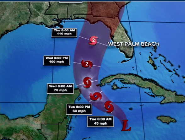
Weather.com – Tropical Storm Helene is expected to form in the western Caribbean Sea and is forecast to intensify into a strong hurricane before it strikes Florida or the northern Gulf Coast later this week.
Interests along the U.S. Gulf Coast from Louisiana to Florida should monitor this situation closely, stay updated on how the forecast unfolds in the days ahead and have their hurricane plans ready to go.
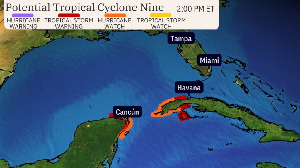
A hurricane watch and tropical storm warning have been issued for parts of Mexico’s Yucatan Peninsula, from just west of Cancún to Tulum, including Cozumel. They are also in effect for parts of western Cuba, generally west of Havana.
This means tropical storm conditions are expected and hurricane conditions are possible in these areas within the next 36-48 hours.
A broad area of low pressure is in the western Caribbean Sea. Thunderstorms are gradually becoming more organized in this area.
It’s been dubbed Potential Tropical Cyclone Nine, a procedure NHC uses to issue watches and warnings ahead of time, before a tropical depression or storm forms.

The National Hurricane Center is forecasting Helene to rapidly intensify from a tropical storm to a Category 2 hurricane over a record-warm Gulf of Mexico – a feat becoming more likely as the world warms due to fossil fuel pollution.
It could strengthen more than forecast, and the NHC warns there is a chance for a Category 3 major hurricane.
Strong, potentially damaging winds and storm surge are likely near where the system ultimately comes ashore. The system will also churn up seas in the Gulf and could produce rough surf and dangerous rip currents for much of the basin, especially later this week.
The National Hurricane Center is showing a landfall in Florida’s Big Bend region, but anyone from Florida’s Gulf Coast to eastern Louisiana should be on alert this week.
Confidence in the system’s exact track will increase after it forms, since forecast models struggle to accurately pinpoint where it could go without a center to lock onto.
Ensemble forecast models – groupings of many model runs initiated with slight differences to show a wide range of outcomes – are focusing on the eastern Gulf Coast as the area most likely for a landfall later this week. When ensemble tracks bunch closer together it means there’s more confidence in the track.
There’s a closer grouping with this storm along the eastern Gulf Coast, but given it hasn’t formed yet it’s not a guarantee.


