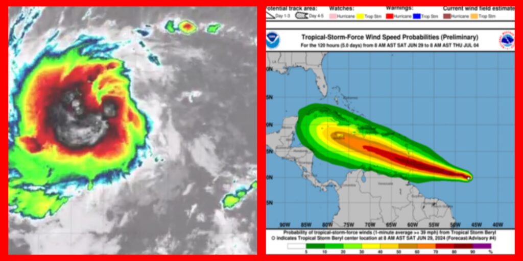
Tropical Storm Beryl, soon to be season’s first hurricane

Tropical Storm Beryl continued to strengthen overnight as it approached the Windward Islands, where it is expected to cross as a Category 1 hurricane Sunday and Monday.
From there, the latest forecast from the National Hurricane Center kept Beryl on a westward track, into the center of the Caribbean.
There, it could find warm water and favorable wind conditions, enough to strengthen Beryl into a Category 2 hurricane.
On it current track, the Beryl could cross Jamaica late Wednesday on a path that South Florida will need to monitor over the coming week.
As of the 8 a.m. Satruday update, Beryl was about 975 miles from Barbados, headed west at at a rapid 21 mph, with maximum sustained winds around 60 mph.
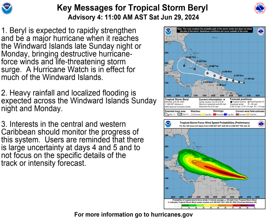
11 AM AST Saturday Key Messages for Tropical Storm #Beryl. Rapid strengthening is expected and Beryl is forecast to become a major hurricane before it reaches the Windward Islands.
The storm is likely to bring destructive hurricane-force winds and a life-threatening storm surge to portions of the Windward Islands late Sunday night or Monday.
Hurricane Watches have been issued for much of the Windward Islands.
11 AM AST Saturday Key Messages for Tropical Storm #Beryl. Rapid strengthening is expected and Beryl is forecast to become a major hurricane before it reaches the Windward Islands.

The storm is likely to bring destructive hurricane-force winds and a life-threatening storm surge to portions of the Windward Islands late Sunday night or Monday. Hurricane Watches have been issued for much of the Windward Islands.
As of Saturday morning, Barbados remained under a hurricane watch.
If Beryl becomes a hurricane on Sunday, it would be the farthest east a June hurricane has formed in the historical record. Only one other hurricane has formed anywhere nearby in June, and that was in 1933.
By Tuesday, the hurricane center noted that conditions could shift, and a strong subtropical ridge that is expected to keep the storm at lower latitudes could lighten, allowing Beryl to inch into higher latitudes.
That shift could also bring additional wind shear to the area, which could help batter the storm back down to a Category 1 hurricane.


