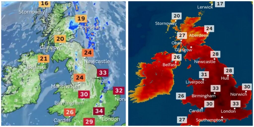
Office show blistering forecasted temperatures of up to 34C in some places in the UK

Britain forecast mega 34C scorcher today – Met Office weather map shows hour-by-hour heat burst.
Most of the high temperatures will be concentrated in the south, with northern areas facing spells of heavy rain and thunderstorms in the morning with a slightly cooler outlook for the day.
East Anglia and eastern parts of central England will face the brunt of the hot weather, with the Met Office predicting humid conditions.
Temperatures are set to peak at 34C in London today, with highs of 32C in Norwich, 29C in Southampton, 30C in Birmingham, 24C in Manchester, 33C in Hull, 24C in Newcastle and 20C in Glasgow.
However, the Met Office has warned that “some isolated afternoon thunderstorms are possible in eastern England”.
The Met Office took to X, formerly Twitter, to share an update on today’s conditions, writing: “Torrential downpours and thunderstorms across Scotland and northern England this morning, clearing the east this afternoon.
Lots of sunshine elsewhere though isolated thundery showers are possible. Hot and humid across England, especially in the east.”
Temperatures are expected to peak at around 2pm this afternoon, with many areas seeing highs in the 30s and 20s.
Warm European air was behind a particularly warm day yesterday, with the potential for today to become the hottest day of 2024.
So far, the hottest day of the year was July 19, when temperatures reached 31.9C in central London, with some areas forecast 34C, today could top that.


