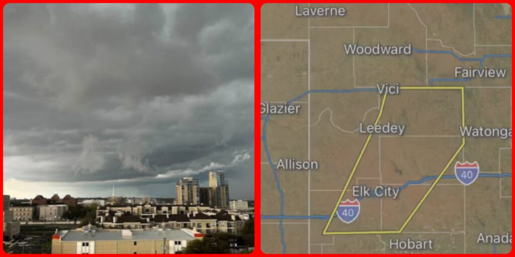
North Texas counties under tornado watch, few under tornado warning.
A “potent storm system” is moving through North Texas Tuesday morning, ushering in a threat of heavy downpours, risk of spin-up tornados and isolated instances of large hail, according to the National Weather Service.
A tornado Watch is in effect for the major Dallas-Fort Worth counties, including Collin, Denton, Dallas, Ellis and Tarrant. Many surrounding counties also are under a tornado watch until 11 a.m. Tuesday.
NBC5 (KXAN) meteorologists warn of high winds with gusts up to 60-70 mph. The storm is moving west to east across the metroplex, sparking isolated tornado warnings, including Tarrant and Johnson counties.
Some cities, including Burleson and Dallas, activated their storm sirens a little after 5 a.m.
The storm could impact the morning commute for North Texas drivers, forecasters said.

There was a 100 percent chance of rain on Tuesday, with NBC5 meteorologist Grant Johnston saying the line of rough weather will move in from the west toward Dallas-Fort Worth during the early morning hours and will intensify.