The storm, which began as snow before transitioning to sleet and then freezing rain in some areas, created hazardous conditions for drivers and pedestrians alike on Thursday.
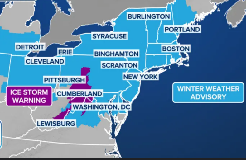
Winter weather advisories were expanded to include all the New York City metro, northeast New Jersey, Westchester and southern portions of Connecticut
Be prepared for a messy morning in #NYC.
— NY1 Weather (@NY1weather) February 6, 2025
@johndavittontv says a wintry mix of snow, rain and sleet will soon turn to all rain before drying out. But another winter storm arrives this weekend.
pic.twitter.com/4vaYGK7NPS
Dangerous travel & hazardous icing is the primary impact. It’s slippery on untreated surfaces. The slippery conditions are leading to vehicle crashes and slips/falls. It wraps up by 2pm.
Please reconsider traveling until later. It’s no bueno
- Snow and sleet, possibly mixed with freezing rain before 10 a.m., then rain. Patchy fog after noon. High near 39. The chance of precipitation is 100%.
However, warm air will then flood in, changing the snow to either freezing rain or plain rain.
Snow and sleet accumulations of up to 3 inches were possible for most of the Tri-State area.
As for ice accretion, a glaze is possible across portions of NYC metro, western Long Island and coastal Connecticut.