9 Inches of Snow Expected: Winter Weather alert
Published by RawNews1st
The advisory affects the White Mountains, high terrain south of the Yukon River, and the Chatanika River Valley, including key stretches of the Steese and Elliott highways.
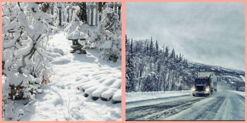
The early season storm is set to deliver moderate to heavy snow across interior Alaska, raising the risk of hazardous travel conditions. The NWS has specifically warned motorists and residents to be alert for slippery roads and reduced visibility.
“According to record, the Fairbanks area typically gets their first inch of snow on October 9th, so we are about two weeks ahead of schedule,” NWS Fairbanks posted on X. “This snow is unlikely to stick around, but keep an eye on the horizon as winter is coming!”
The advisory comes as Alaska begins to transition into the colder months, making preparedness especially crucial for local communities and travelers on major routes.
The winter weather advisory is in effect from 2 p.m. local time Thursday until 10 p.m. Friday, according to the NWS office in Fairbanks. The agency predicts snow accumulations between 4 and 9 inches, with higher elevations receiving the most snow.
Areas most affected include the Steese Highway up to mile marker 90 and the elevated portions of the White Mountains. The snowfall is expected to begin with a weaker weather system Wednesday night, intensifying as the main storm moves in Thursday night through Friday morning.
The coming storm is anticipated to have significant travel impacts, particularly during the Thursday evening and Friday morning commutes.
“Plan on slippery road conditions. The hazardous conditions could impact the Thursday evening and Friday morning commutes,” the NWS said in its advisory issued at 4:44 a.m. Wednesday.
Motorists are urged to slow down, use extra caution, and check current road conditions by calling 511. Residents should also be cautious on outdoor surfaces such as stairs and sidewalks, as these may quickly become icy and increase the risk of falls or injuries.
“Moderate to heavy snowfall is expected for the White Mountains, with the highest amounts reaching the Steese and Eagle Summits and Upper Chatanika Valley Thursday evening into Friday night. Mixed precipitation is expected at lower elevations.”
What Happens Next
In addition to reducing speed and driving cautiously, the advisory recommends that anyone heading outdoors should use care on potentially icy paths. The NWS further suggests that individuals stay up to date with the latest advisories and updates posted on their official website and via local communication channels.